Distance Covered: 33 Km (20.5 miles), 2,480 feet ascending, 2,550 feet descending
Picking up where we left off last evening: the town of Navia on the Cantabrian Sea. It’s a picturesque town of 8,500 residents, with lots of restaurants and a charming downtown. We took a walk in the evening, as the town was beginning its Medieval Fair celebration this weekend. People were crowded into the streets and bars, many of them in period costume. Vendors were setting up their stalls, kids were frolicking around. It was a picture-book setting.
 | |
| Paco at the Medieval Wall |
 | |
| Medieval Fair Preparations |
 | ||
| Town Folk in Costume |
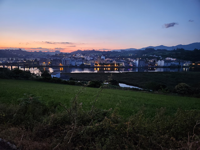
This morning, we got up at 5:30 am, enjoyed an iced latte at the hotel, and were on the road at 6:10 am. We had a lot of ground to cover and didn't want to walk in the midday heat. So we left in the dark. It was magical.
 |
| Leaving Navia |
 |
| Daybreak Over Navia |
This was our last day of walking in the province of Asturias. It was a bit wistful, looking at the countryside, the beaches, the ocean--for the last time. We couldn't stop marveling about the beauty of this part of the world.
 |
| Early Morning Views of the Asturian Countryside |
 |
| Glimpses of the Ocean in the Distance |
We arrived in La Caridad around 8:30 am for coffee. This is a small, kind of depressing town with little going for it--except that it's the end of a "Stage" of the Camino. Authors and Camino planners steer pilgrims from Luarca to this town to spend the evening. It's a real shame. There are few amenities to greet tired pilgrims, just lots of boarded up buildings, quiet streets, few people, few restaurants and bars. It's nothing compared to Navia.
So why does this town get the authors' attention? Back in the 19th century, it apparently showed great hospitality and charity to pilgrims passing along the way. The town was re-named La Caridad (Charity) and has remained a focal point ever since. Hmm.
Our walk across the coast continued, with its usual frustrations; namely: inconsistent route markings. Sometimes, route planners change the “official” route to avoid dangerous situations (such as railroad crossings), or to account for new construction that otherwise obscures The Way. However, they often don’t do a good job highlighting which of the competing signs the pilgrims are supposed to follow. Some arrows point in one direction, others point elsewhere. It’s up to you to figure out which one to follow. Very annoying.
 |
| Modern Camino Marker |
This is an example of a more modern sign that we’ve found to be quite reliable. There's a capital C for Camino, and an arrow pointing to the S for Santiago, showing the direction you're supposed to go. It’s different from the shell and the yellow arrow, which are much more prevalent. If there’s a discrepancy between signs, we follow this one!
Our mid-day break was in the town of Tapia de Casariego. It’s set on a peninsula with beautiful beaches, both rocky and sandy. The town square was bursting with people enjoying the cloudy morning. We saw one of the French travelers in the bar, and two other American girls we spied this morning at La Caridad. We complimented each other on our matching REI knapsacks!
 | ||
| Nearing Our Mid Day Break in Tapia |
 |
| Sandy Beach in Tapia |
By this point, we were only 12 kilometers from our destination, which was lucky because the weather was becoming increasingly cloudy and threatening. We encountered scattered showers at some points, and even broke out our handy-dandy rain slickers for a spell. The clouds dissipated, and we almost made it to the bridge spanning the Ribadeo River that separates Asturia and Galicia--when the rain really started to pour. Out came the rain slickers, Paco in his Mickey Mouse costume and me in complimentary Smithsonian blue-and white. We made quite the pair!
 |
| Mickey crossing the bridge to Galicia |
We made it to the hotel, wet and tired, a little after 3:00 pm. Next came a late lunch featuring classic Galician dishes such as Chipirones a la Plancha (grilled baby squid) and Pulpo a Feira (octopus with olive oil and smoked paprika), and some time to relax.
 |
On the trip so far, we've covered: 150 Km (93 miles), 12,828 feet ascending elevation, 12,736 descending elevation.
Distance to Santiago: 200 Km (124 miles)
No comments:
Post a Comment